Day 19. Thursday, 16/06/2011: Muir of Ord to Altnaharra
Actual riding distance 105km. Ascent 858m. Total distance 1919km. Total ascent 16807m.
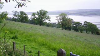 Cromarty Firth.
It was a fine morning outside as we ate our breakfast: blue sky, no wind almost perfect for cycling. The only potential problem was the temperature. I took a chance and packed my jacket into the pannier. It was quite cool out of the sun but tolerable in the sun. The only problem with the beginning of the ride was that a lot of it was shaded by trees so quite cold.
 Oil rigs in the Cromarty Firth.
As the morning went on it warmed slightly and by the time we made Dingwall it was getting bearable. Climbing out of Dingwall the Cromarty Firth came into view. This piece of water is used to park out of work oil exploration rigs and quite a few were moored in the sheltered waters.
 Struie Hill.
At Evanton we turned more northerly to start our climb over the Struie: a local shortcut to save going around the coast via Tain on the A9. This road is much less busy now that the Dornoch bridge carries the A9 as that brings traffic onto the south of the Dornoch Firth east of the start of the Struie road.
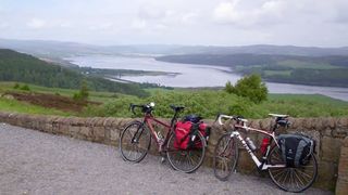 View north towards Bonar Bridge.
This road climbs to 217m before dropping to 185m where it crosses Strath Rory. It then climbs again to 238m before dropping again to 203m before the final climb to 215m. I must admit that I rather blasted up this as it was the last big climb of the trip and I have rather enjoyed the rest of the hills on the trip. A short distance past the summit there is a viewpoint where the view to the north and northwest is rather fine where I waited for Neil and Ron. We dropped down to the old A9 which skirts the Firth as it makes its way to Ardgay and Bonar Bridge. At Ardgay the NCN 1 turns off towards Carbisdale castle but right at the jucntion is a cafe and expensive, high class outdoor clothing shop for the well to do - full of tweeds etc. We had a coffee and cake stop here and ordered sandwiches and cakes for lunch as we were about to leave civilisation and head out into the wilds of Sutherland.
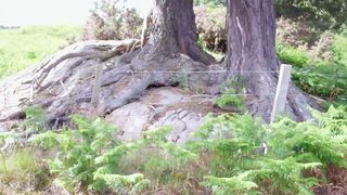 Old tree roots.
The scenery along this bit of road was very fine including views of Carbisdale castle through the pylon lines that run parallel to the road. The road also crosses the railway a couple of times and then runs beside it before a narrow track leads off towards the Shin viaduct.
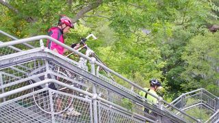 Footbridge alongside Shin Viaduct.
NCN 1 is carried on a walkway attached to the side of the railway viaduct but it has the major disadvantage that it has to be approached down a couple of flights of steps. To make matters worse there is no ramp at the side to run the bike wheels along so the bike and panniers have to be carried or bumped down the steps. It was bad enough with our loads: carrying camping equipment in front and back panniers would necessitate removing panniers and carrying them down separately.
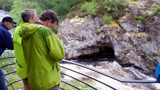 Shin Falls
A while later NCN 1 turns off again and heads towatds the Falls of Shin and its visitor centre (now no more after a fire). The falls are OK but not special enough to deserve the infrastructure that has been developed beside them. The amount of the falls that can be easily visited is just a tiny percentage of the total and it really needs a longer path up much more of the riverbank to do it justice.
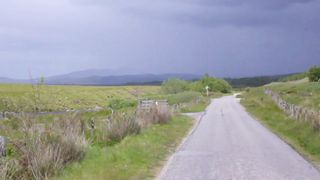 Heading towards the rain.
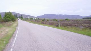
After Lairg we headed north on the Tongue road which slowly climbed up Strath Tirry. The weather in front of us looked quite bad. The clouds were low and dark and it was obvious that there was a lot of rain falling but somehow or other we managed to miss almost all of it. The road was now single track with passing places so it was a good job that it was not too busy.
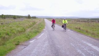 Wide open Sutherland.
The odd big logging lorry made it necessary to take refuge in passing places but in general the car traffic we met was back to Cornwall standards of behaviour and many cars waited at passing places for us to pass them by. The country side here is generally wide open expanses of moorland with non native plantations that are being harvested and the odd big mountain. In the middle of the nothingness is Crask Inn. We stopped there for tea and shortbread.
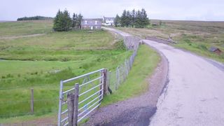 Lonely Crask Inn.
It is difficult to see how this place can survive at the present and even more difficult to imagine that someone would be prepared to take it on when the present proprietors move on. It is quite strange to be drinking in what is to all intents and purposes someone’s lounge. We left Crask and made the final climb over the watershed to the area where the rivers drain to the north. We arrived at our B&B before five and were joined a bit later by another End to Ender and travel companion. We all had dinner here before visiting the local hotel for a pint. Only one day to go now and it will be over. I think each of us has different emotions about this so I will try and collate the thoughts from the others with mine once we do finish.

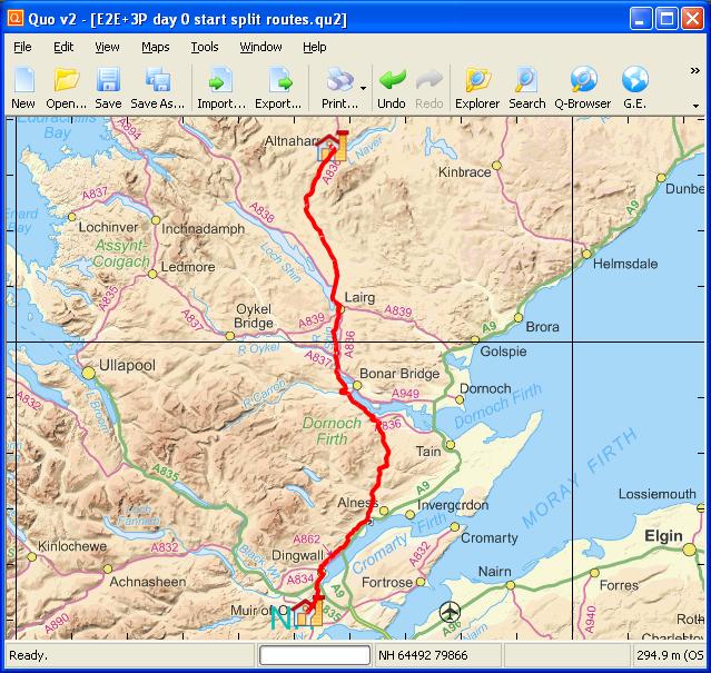 Day 19 track
 Elevation plot Day 19
