Day 18. Wednesday, 15/06/2011: Fort William to Muir of Ord
Actual riding distance 117km. Ascent 650m. Total distance 1814km. Total ascent 15949m.(all estimated due to GPS problem)
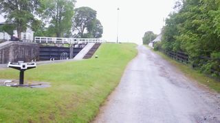 Neptune’s staircase, Caledonian Canal.
What a difference in two days. Yesterday it was blue skies and this morning it was grey, low cloud and drizzling. It is a good job we were not going up the Ben today. With an early start we abandoned the NCN route from Achintee to the Caledonian Canal and instead went up the A 82 and West along the A 830 before turning off onto the little back road past the school and the Inverlochy campsite.
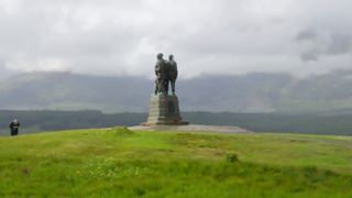 Commando monument near Spean Bridge.
Near the end of this road we turned off up a lane onto the canal towpath at Neptune’s staircase. This set of locks raises the level of the canal by 70 feet from the sea. Once up the top of the staircase we had a long level run along the towpath, up another few feet past another lock and then level again to Loch Lochy.
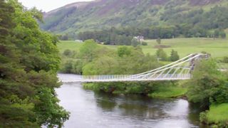 Bridge of Oich.
There are no towpaths along the sides of the lochs and an alternative forestry track is very rough and not really suitable when carrying panniers so we had to leave the canal and follow the road up to the Commando Monument. Here was going to be the first unpleasant bit when we joined the A 82. In the event it was not quite as bad as we feared as the level of traffic was not too heavy at that time.
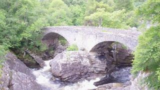 Bridge at Invermorriston.
We were on the road as far as Laggan where we went in search of tea, coffee and cakes. The place we called in at did not open for another 25 min and to make things worse, the chef had called in to say he would be late and he had the keys for the kitchen. The girl at the desk suggested a tearoom at the other end of Loch Oich. There were two ways to get there; along the main road or along the track of the old railway.
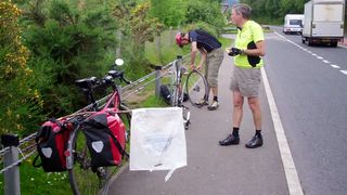 Neil mending his third puncture and my flag to get more space.
The beginning of this track looked okay but as it went on it deteriorated quite badly. In several parts, tree roots spread across the whole width of the path making progress very difficult. Neil had to walk all of these bits (note now though that this part is a properly constructed cycle path). We eventually came out at the Aberchalder swing bridge and the little tea room was close by. We crossed the canal to have a look at the historic Bridge of Oich. After tea and cake we did more towpath travel.
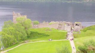 Castle Urquhart above Loch Ness.
Going along this stretch, I noticed that the batteries on my GPS had just run out so I stopped to change them. When I restarted it, it kept hanging just like it had done when I was coming home from Glencarron at Easter. I tried to do a reset on it but to no avail so it was very useful that we were travelling on familiar territory and that Ron had maps of where we were going. At Fort Augustus we had no choice but to follow the main road.
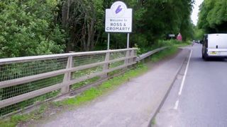 Into Ross and Cromarty.
By this time the traffic was getting busier and it was getting very unpleasant to have cars, buses and lorries trying to squeeze past. I had seen devices for bikes that try to keep vehicles further away and after a bit of thought I solved the problem with a branch from a horse chestnut tree and a polythene bag. This seemed to do the trick quite nicely. We called in to the visitor centre at Castle Urquhart to try and get a cup of tea to have with the sandwiches we had made up for ourselves but you had to pay the entry fee to get to the cafe!
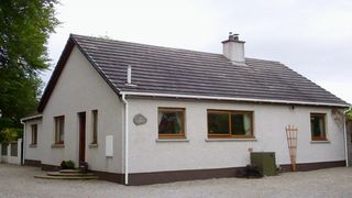 The Gables, Muir of Ord.
We decided to go on to Drumnadrochit and just as we were leaving the car park Neil suffered his third puncture. This time though, he had a new tyre to put on that he had been carrying since Kendal. The tyre was duly fitted and we found ourselves a cafe doing takeaway drinks. I had a fiddle with my GPS and discovered that I had moved the clip that holds the SD card for my maps in place when changing the batteries making a bad contact between the card and the GPS. I clipped it back in properly and the GPS started up OK. The only problem was that I had lost the track from Fort William to Drumnadrochit which was a pity. Just as we were finishing lunch it started raining quite hard so we took cover under the umbrellas of the cafe where we had bought our drinks. While we were sheltering another two End to Enders stopped to chat. They were heading south and had already had problems cycling into the wind. Leaving Drumnadrochit we took the road for Cannich before turning north towards Beauly up a steep hill. Once at the top, it was almost all downhill or level to Beauly and then on to Muir of Ord. We arrived at the Gables at about 5:30 PM giving us time to do various things before heading out to dinner.

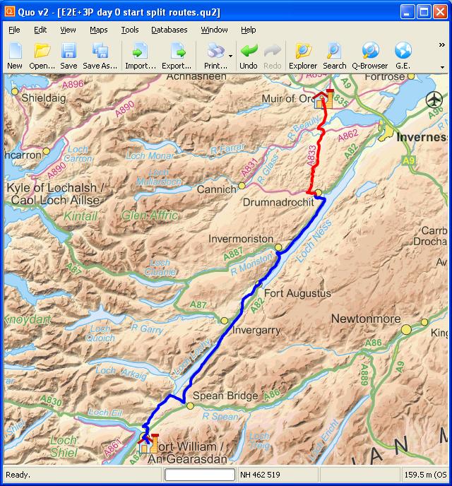 Day 18 track (lost GPS track in blue)
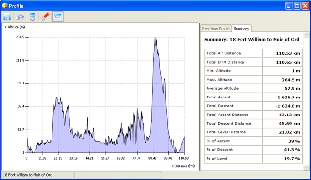 Elevation plot Day 18
