Day 13. Friday, 10/06/2011: Threlkeld to Dumfries
Actual riding distance 122km. Ascent 589m. Total distance 1313km. Total ascent 12550m.
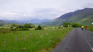 View back to Threlkeld.
It was quite cold this morning with showers still threatening. From Threlkeld we followed the general line of the A66 east for some way before turning north to follow NCN 71 then NCN 7. Some way north we passed the Skelton transmitter and both Neil’s and my bike speedos stopped working for abouut three or four miles. I guess they were being swamped by the strength of the signal from the aerial. I dread to think what it does to brain cells.
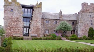 Stunning renovation.
A bit later we passed an old partially fortified building that had been recently renovated in a very spectacular manner. I’m sure the occupants will soon become fed up with people like us stopping and photographing their home.
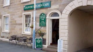 Tearoom in Dalston.
Our progress was quite good and we were almost on the outskirts of Carlisle by coffee time. We were going to go into Carlisle but a tearoom was spotted in Dalston so we took our break there. On the outskirts of Carlisle we met another two cyclists who turned out to also be doing the LE2JoG+3P but from north to south so we are not the only mad, sad cyclists. They are due to finish the day after us.
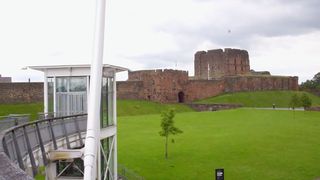 Carlisle Castle and bike bridge.
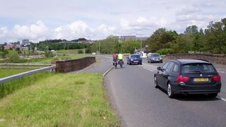
Our route through Carlisle basically followed the River Caldew right into the centre where we were confronted with crossing a dual carriageway. There was a fine newish bridge but the lift to get us up to it was under repair so we had to carry our bikes up many steps to get to the bridge and back down the other side. Underpasses are much easier to maintain!
 Crossing the border at Gretna.
We followed the River Eden north west from the centre before turning back towards the M74. My maps did not show it but a new road had been built to the west of the main road to carry non-motorway traffic and we followed this over the railway before turning north west towards Gretna. The border here follows the centre of the River Sark and the crossing into Scotland is at the centre of the bridge over it. Confirmation of arrival in Scotland is a bit past the bridge and we set up the camera to record our return to home soil - this collection of a Scot, an Englishman and a Welshman. It did feel good to be back home.
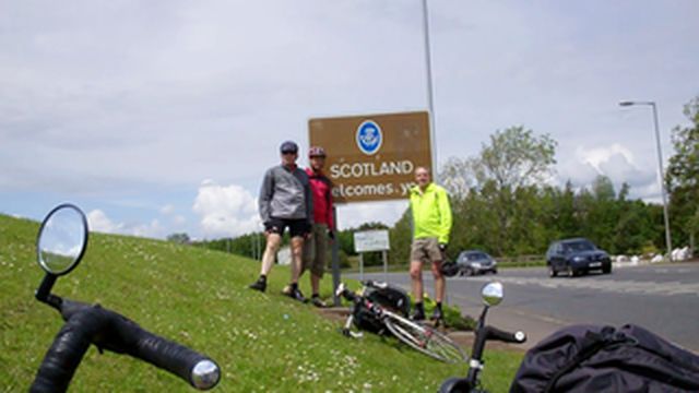 Back in Scotland.
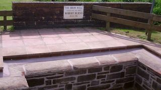 Brow Well where Burns took the Waters in an attempt to cure his tuburculosis.
After Annan we split up for a bit as Ron, with a change of tack from his origianl plan to follow the NCN routes wanted to make faster progress along the B724. On the other hand I wanted to follow the planned route that was closer to the Solway Firth.
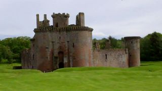 Caerlaverock Castle.
By this time it was very evident that there was a lot of rain around to the north and the more southerly route was not so badly affected. While I was sheltering under some trees from some light rain Neil and Ron turned up having left the main road. There was a choice of route from Bankend and Neil and Ron took the right option for the more direct route to Dumfries while I chose to turn left and again follow the planned route that would take me past Caerlaverock Castle and Caerlaverock Nature Reserve.
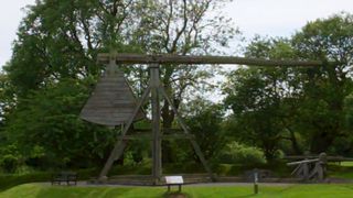 Trebouchet at Caerlaverock.
The lure of the tearoom at Caerlaverock was too strong so I turned in and had myself a pot of tea and a piece of chocolate cake before getting a ticket to visit the Castle. This is a stunning castle that has been the scene of several seiges. It must have been a very grand place to be in its heyday. The first castle here dates from 1220 and was likely to have been the first stone built castle. Its location from the defensive position was good but the soft ground led to it sinking and it was abandoned and the newer castle built.
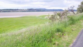 Nith Estuary.
After leaving Caerlaverock the road follows the Nith estuary for a long way before leaving it and taking to higher ground before descending into Dumfries. About a mile from the B&B I thought it prudent to stop and don waterproofs but in the event the rain eased off a bit but it was better to be safe than sorry. It was not so easy to navigate with water sitting on the screen of my GPS and on my glasses but I managed to follow the pink line and arrived at the B&B just after six.

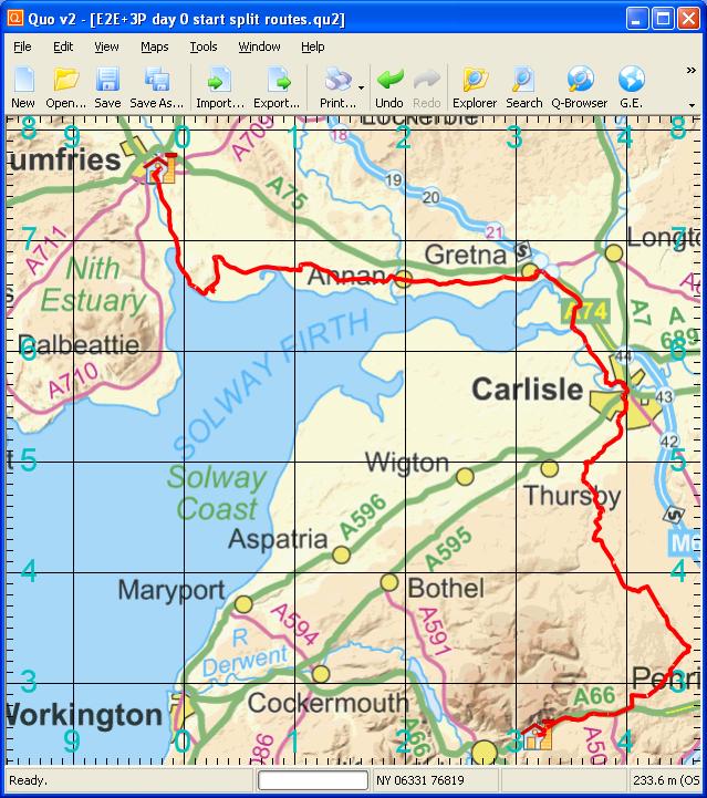 Day 13 track
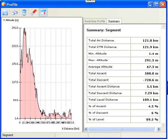 Elevation plot Day 13
