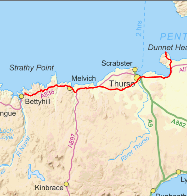
Day 6. 5/6/2014. Cycle Bettyhill to Dunnet head (northerly point) to Bettyhill. Distance cycled 136.9km. Ascent 1481m. Cumulative distance cycled 732.9km. Cumulative ascent 6175m.
Third objective achieved today. Most northerly point on Scottish mainland.
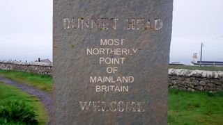
Dunnet head says the sign but where is the northernmost point?
Today was a day to rise to the challenge. It should have been luxury today as I was able to ride without panniers to Dunnet head, the most northerly point of the trip. That would have been the case if the weather had not been so foul. As it was it rained, sometimes quite hard, as far as Thurso and the wind was against me almost all the way to Dunnet head. It was also quite cold. I had made the decision to go without my waterproof trousers as they give a lot of drag over the knees when pedalling. It was probably a mistake as the combined effect of the rain, wind cold and my speed into the wind made it quite chilling.
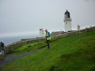
Northernmost point.
Due to the conditions I didn't attempt to take any pictures until I arrived at my destination. It was a solo trip as Neil had decided that his body could do with a rest and he needed time to read Alex's PhD thesis. That was one reason but the weather was probably just as important. The road along the north coast is very up and down as it crosses all the small valleys heading to the coast as you can see if you open the Ride With Gps page. In fact it had the biggest daily ascent of the whole trip.
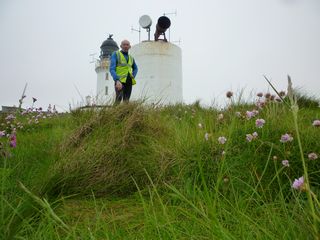
Dunnet head lighthouse.
I had intended to stop in Thurso on the way out (and back) to split the journey into three parts but being so wet I decided I would press on as I had been told there was a nice little cafe south of the lighthouse. Arriving at the lighthouse and not finding the cafe there was quite a disappointment but I had some food with me to keep me going until I could find said cafe on the way back.
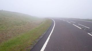
Fog on the way home.
There is nothing to indicate where the most northerly point is but it was obviously somewhere close to the lighthouse. After some wandering about I could see my goal on the other side of a wall that stopped at the cliff edge. To get there required me to climb over the other end of this wall where projecting blocks were set into it to form a stair. Once over I made my way to as near the edge of the cliff as I thought safe as the grass was wet and slippery. With no assistant to hold the camera I had to experiment with the camera set on a bit of wood that was lying around. The result above is the best I could manage. On my way back I was very keen to find the cafe. I had a late lunch there then made a rather quick run back to Farr thanks to the wind that was now behind me. There was quite a bit of fog on high ground on the way home. This was not so good especially when four sheep appeared out of it in front of me on a fast descent!

Click map to see full details of this day's ride in Ride With GPS.
